
The following ten islands are the largest in the world compared by area. Continents aren’t taken into account. I.e. Australia has an are of 2,900,000 square mile, and Afro-Eurasia 32,500,000 square mile.
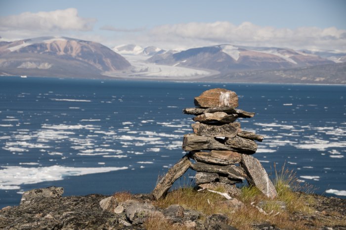
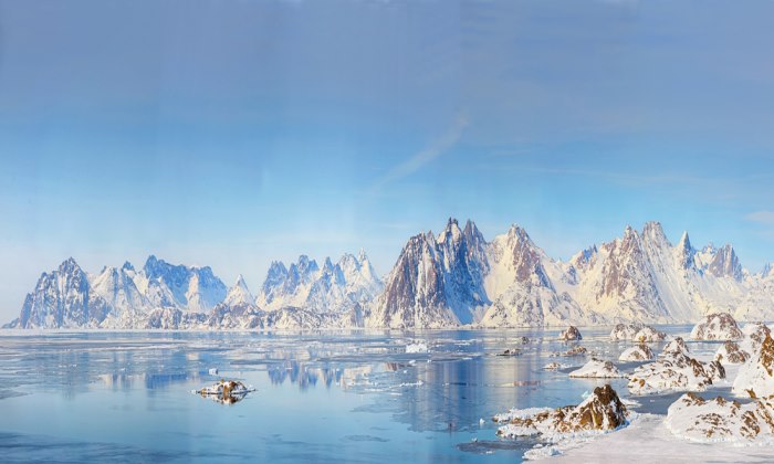
10. Ellesmere Island – Canada(87,182 sq mi)
Within the Canadian Arctic Archipelago, Ellesmere Island is one of the Queen Elizabeth Islands, and contains the most northerly point of Canada in Cape Columbia. With an area of 87,182 square miles, Ellesmere Island is dominated by the Arctic Cordillera mountain system, making the island the most mountainous in the Canadian Arctic Archipelago. Drawn to the island for the hunting (mainly of musk ox, caribou and marine mammals), the first human inhabitants made their appearance sometime between 2000–1000 BC. In 1616, William Baffin, the namesake for Baffin Island, the fifth largest island in the world, became the first European to sight the island. Currently, Ellesmere Island is still largely uninhabited, the population recently recorded clocking in at a mere 146.
9. Great Britain – England, Scotland, Wales(80,823 sq mi)

Great Britain may only be the ninth largest island, but it undoubtedly is the best known. With a history as one of the most prosperous empires the world has ever seen, Great Britain now consists of England, Scotland and Wales, with the United Kingdom including Northern Ireland in Britain’s political jurisdiction, as well as fourteen British Overseas Territories. British cultural influence, as well as the English language, remains intact throughout many of its former colonies. Lying off the north-western coast of continental Europe, Great Britain is located in the Atlantic Ocean, and is surrounded by more than 1,000 smaller islands. Great Britain is home to a population of about 62 million people, most of whom reside in the capital cities of London, Edinburgh and Cardiff. With its political standing as a constitutional monarchy with a parliamentary system, Queen Elizabeth II holds the throne, as the current British monarch. Great Britain and the UK continues to carry considerable international influence in economic, political, military, cultural, and scientific fields.
8. Victoria Island – Canda (83,897 sq mi)
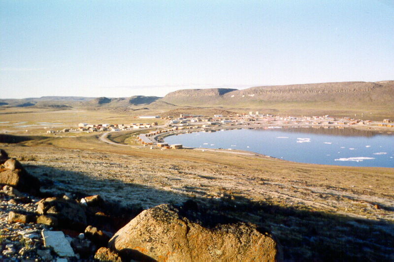
Named after Queen Victoria, Victoria Island lies in the middle of the Canadian Arctic Archipelago, and claims the spot as the eighth largest in the world, at 83,897 square miles. Victoria Island is remarkable for its constitution as the world’s largest island within an island within an island. An island of peninsulas, with a coastline consisting of many inlets, the island wholly resembles a maple leaf, which is the main symbol of Canada, being the focal point of its national flag. Victoria Island’s highest point is in the Shaler Mountains, at an elevation of 2,149 feet. The island’s population is around 1,875 residents, most of whom live in Cambridge Bay, along the south-east coast.
7. Honshu – Japan (87,182 sq mi)
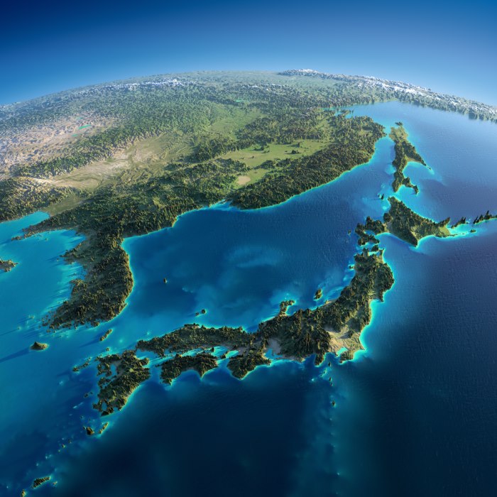
As Japan’s largest and most populous island, Honshu, at 87,182 square miles, is the seventh largest in the world. Japan’s main island lies across the Insland Sea, north of Shikoku; across the Tsugaru Strait, directly south of Hokkaido; and across the Kanmon Strait, northeast of Kyushu. With a population of more than 103 million, 25% reside in the Greater Tokyo Area. Honshu’s industry is mainly located along Taiheiyo Belt, a range of Honshu’s southern coastal cities. The north-western coast’s economy consists largely of agriculture and fishing off the Sea of Japan. The island’s capital, Niigata, is one of the most notable producers of rice, while the Kantō and Nōbi plains economy is based on the production of both rice and vegetables. The Japanese Alps run the length of Honshu, including amongst them the highest peak and active volcano, Mount Fuji (12,388 ft). Many rivers cross Honshu, the Shinano River being its longest and most notable. The climate is temperate, but not unified throughout; the eastern and southern half often exhibits a markedly different temperature and climate than the western and northern half.
6. Sumatra – Inonesia (184,954 sq mi)
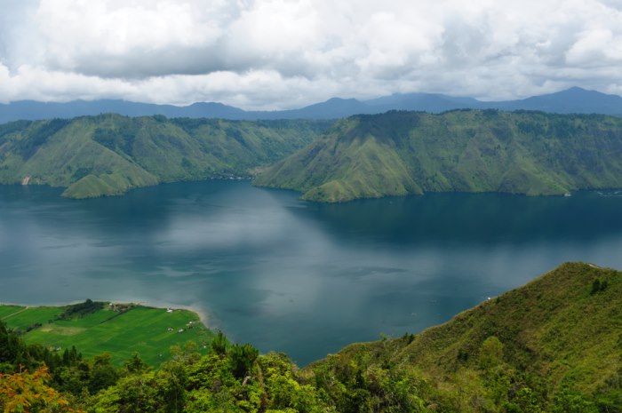
An island in western Indonesia, Sumatra is located to the west of the Sunda Islands and covers 184,954 square miles. With a population of almost 50 million, its largest city is Medan, which accounts for over 4 million of the total. Sumatra lies in the Indian Ocean, bordered to the southwest by the island chain of Simeulue, Nias and Mentawai. Containing several active volcanoes, the Bukit Barisan Mountains fracture the south west of the island, while the northeast consists of a complex river system, creating much of the area’s lowlands and swamps. With the equator dividing the island at its centre and lush tropical rain forest covering most of its landscape, the climate maintains its tropical hot humidity year-round. As a result of its rain forest environment, Sumatra is also home to a large variety of plant and animal species, many of which are endangered, the island having lost almost 50% of its tropical rainforest in the past four decades.
5. Baffin Island – Canada (195,928 sq mi)
Baffin Island is the largest island in Canada and the fifth in the world, with an area of 195,928 square miles and a small population of close to 11,000 people. Though Baffin Island’s namesake was English explorer, William Baffin, the island was likely first realized by Norse explorers from Greenland and Iceland. Researchers indicate it may, in fact, be the location of Helluland, referred to in various Icelandic sagas. To the south, Baffin Island is separated from Quebec by the Hudson Strait; to the east, the Davis Strait and Baffin Bay separate it from Greenland; and to the west and north, the Gulf of Boothia, the Foxe Basin and Lancaster Sound separate the island from the rest of the archipelago. Running along the north-eastern shore of the island, the Baffin Mountains attribute to the Arctic Cordillera. Though Mount Odin is Baffin Island’s highest peak, with an elevation of 7,031 feet, Mount Thor (5,495 ft), has the sharpest vertical drop of any mountain on Earth.
4. Madagascar- Madagascar (226,917 sq mi)
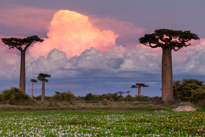
Coming in as the fourth largest island in the world, Madagascar boasts 226,917 square miles of diverse ecosystems and wildlife. An island country in the Indian Ocean, off the south-eastern coast of Africa, Madagascar consists of the larger mainland, as well as a multitude of small nearby islands. Nearly 88 million years ago, Madagascar’s split from India resulted in the evolution of unique native plants and wildlife, 90 percent of which is found nowhere else in the world. Initial human habitation of Madagascar can be dated at sometime between 350 BCE and 550 CE. Austronesian people settled upon the island at this time, producing a fragmented variety of tribal alliances. Not until the late 18th century, did the island unite under the Kingdom of Madagascar, ruled by Merina nobles. This monarchy was absorbed in 1897 when the French colonial empire took control. The island again gained independence in 1960. At present, the population of Madagascar is estimated at around 22 million. Investments in education, health, private enterprise, ecotourism and agriculture are key to Madagascar’s economic development.
3. Borneo – Brunei, Inonesia, Malaysia (288,869 sq mi)
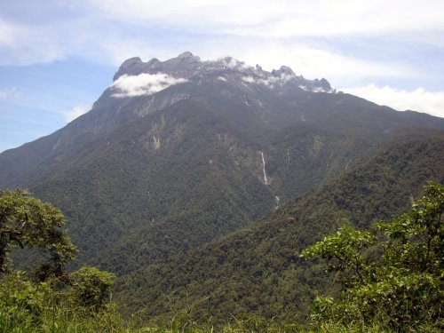
Borneo is a Malaysian island surrounded by many different bodies of water – to the north and northwest, Borneo borders the South China Sea; to the northeast, the Sulu Sea; to the east, the Celebes Sea and the Makassar Strait; and to the south, the Java Sea and Karimata Strait. With an area of 288,869 square miles, Borneo is the third-largest island in the world, and the largest in Asia. Borneo is home to more than 19,800,000 inhabitants, most of whom live in coastal cities, and a large portion of whom are descended from Malay, Banjar, Chinese and Dayak ethnic groups. Mount Kinabalu in Sabah constitutes its highest peak, with an elevation of 13,435 ft. One of the most interesting geological aspects of Borneo is its significant cave systems. For instance, Deer Cave is home to over three million bats; and Clearwater Cave boasts one of the longest underground rivers in the world. Borneo has 19,800,000 inhabitants.
2. New Guinea – Indonesia, Papua New Guinea (303,381 sq mi)
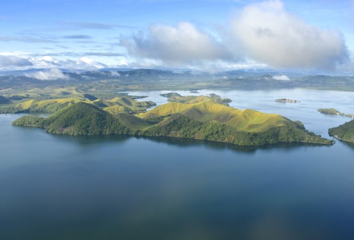
Located in the east of the Malay Archipelago in the southwest Pacific Ocean, New Guinea is the world’s second largest island, covering 303,381 square miles of land. Politically, the eastern half forms Papua New Guinea, the main country, whereas the western half of the island forms the two Indonesian provinces of Papua and West Papua.. Like Greenland, the population density is low, with only about 7.5 million inhabitants. New Guinea experiences high rainfall and active volcanic activity. Its highest mountain, Puncak Jaya, boasts an elevation of 16,023 ft. Similar to Australia’s selection of wildlife, New Guinea’s includes a vast variety of marsupials, such as wallabies and possums, as well as the anteater. Human inhabitants on New Guinea can be dated to the first African migrants over 40,000 years ago. The island’s highlands were suited to agriculture and the subsequent evidence of irrigation there goes back at least 10,000 years. A high number of languages (some 1,000) are spoken in New Guinea, resulting from this long history and the island’s divisive landscape.
1. Greenland – Kingdom of Denmark (822,706 sq mi)
At 822,706 square miles, Greenland is the largest island in the world. Though its physiological location is considered part of North America, stationed between the Arctic and Atlantic Oceans, east of the Canadian Arctic Archipelago, for nearly its entire history, Greenland has been culturally and politically associated with Europe. Three-quarters of Greenland is enveloped by the only current ice sheet outside of Antarctica. This ice sheet may be the key contributing factor to its status as the least densely populated country in the world, with a mere 56,370 residents. Though the current population is small, Greenland has a rich history of inhabitants going back 4,500 years. The first inhabitants were Arctic peoples who migrated from Canada. The uninhabited southern portion of Greenland was settled by Norsemen in the 10th century, followed by the Inuits in the 13th century. After the disappearance of the Norse colonies in the 15th century, Denmark established sovereignty over Greenland, branding it a Danish colony in 1814. Only recently, in 2008, did Greenlanders break slightly away from Denmark, voting in favour of a Self-Government Act which effectively withdrew more power from the Danish to Greenlandic government.
[adsense]
source: Wikipedia
4 Comments
Wales is spelled incorrectly
The Victoria Island pic is of Victoria B.C., not Victoria Island. Very different…
Erm… and Australia?
******* Get more money$27K……on mywork5.com